Route D

The Traditional Downtown of Alicante

All Routes in Alicante

Route A

Maritime facade of Alicante

Route B

Santa Barbara Castle

Route C

Old Town of Alicante

Route D

The Traditional Downtown of Alicante

Route E

Alicante Air Raid Shelters

Services that might interest you

RUTA

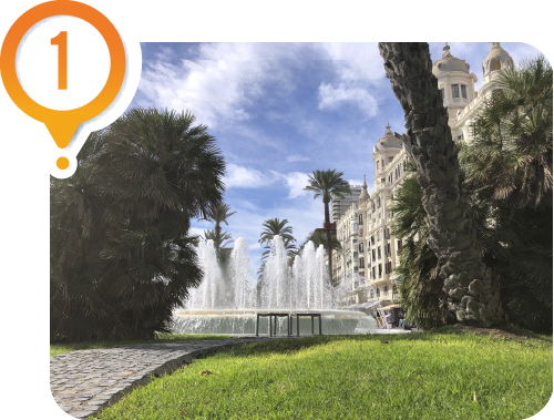
Plaza Puerta del Mar

Alicante was a walled city until the 19th century. In 1858, Queen Isabel II came to Alicante to inaugurate the train connecting the city to Madrid. Taking advantage of this occasion and considering that the city could no longer expand due to its walls, permission was requested from the queen to demolish them. This is how the city began to expand. On this route, we will explore the area where the new city emerged in the second half of the 19th century.

RUTA

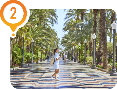
Explanada de España

We must walk along the Explanada to reach this expansion. This promenade was one of the first to be built at the end of the 19th century. After the walls were demolished, the rubble was used to fill the land and create this promenade. Initially, it was called “El Malecon” and later it was renamed to “Paseo de los Martires de la Libertad”. The current esplanade was built in the 1960s and has a total of 6,600,000 tiles. Three colors can be observed, one of which is called Alicante red, a marble color that is only extracted in this area, from there its name.

RUTA

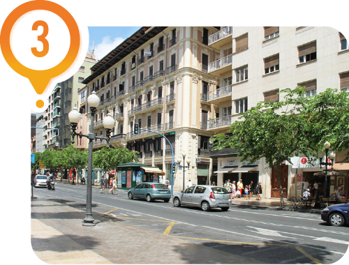
Rambla Mendez Nuñez

This avenue marks the boundary that used to and still does distinguish the old town from the historic downtown (which was yet to emerge). It was the old moat of the wall, where rainwater flowed. For years, the city had barely expanded beyond the rambla, as it served as a natural boundary that the inhabitants preferred not to cross. When the city no longer had space to grow, it was decided to start building on the other side of the rambla.

RUTA

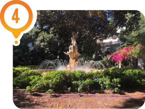
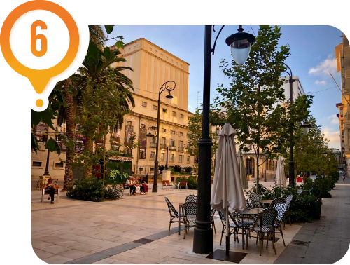
Plaza Gabriel Miro

This area already had buildings before the demolition of the city walls, but it began to acquire its current shape in the 19th century. This square, formerly known as “Plaza de las Barcas”, represents the embodiment of the bourgeois city and the idea of urban beautification of the new ruling class. At the same time as this square was being developed, other squares were constructed across the city, driven by the same desire to beautify Alicante. The current fountain was installed to commemorate the bringing of water from a nearby town in the province in 1898 given the existing need for water supply in Alicante.

RUTA

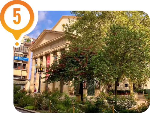
Principal Theater of Alicante

The construction of this new theater in the mid-19th century had two important effects: the affirmation of an ascending social class of merchants who gifted the city its most important public work of the century and solidified an emerging urban structure that served as a bridge between the 18th-century walled city and the new city expansion of the late 19th century. It is a characteristic example of the long series of theaters that were being built in the country at that time. The interior is a representation of the typical Italian-style theater with a horseshoe-shaped floor.

RUTA

Avenida de la Constitución

The entertainment area moved to this region when Alicante began to grow. Here the main buildings of the time were created: the Casa de Socorro, also known as Cine Ideal, was the only surviving structure in the city from the golden age experienced by movie theaters in the 1920s, when they became the favorite pastime of an industrial society.

RUTA

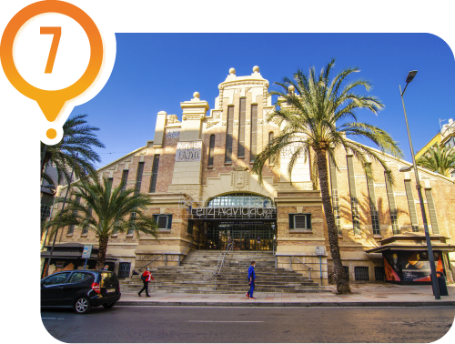
Alicante Central Market

The current Central Market is located on Avenida Alfonso X el Sabio, named after the king who conquered the city from the Muslims in the 13th century. This was the most vibrant area at the time and remains one of the main avenues of the city. This building was built at the beginning of the 20th century and was bombed during the Civil War.

RUTA

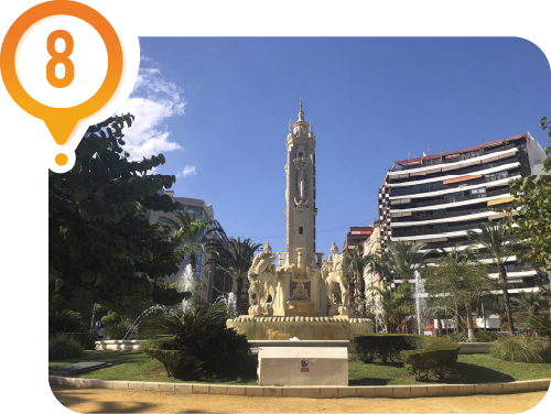
Plaza de Los Luceros

We walked along the Avenida Alfonso X el Sabio which ends at the Plaza de los Luceros, one of the most important squares in the city. Beneath this square, we currently find one of the TRAM stops (metropolitan public transport of Alicante), which allows us to conveniently visit San Juan Beach or explore many tourist towns along the northern coast of the province. The square was built in the early 20th century, but it holds significance for another reason: the city needed urban planning to construct new buildings after the city walls were demolished. Using the square as a central axis, the main avenues were developed. We will take one of these avenues to reach our next stop.

RUTA

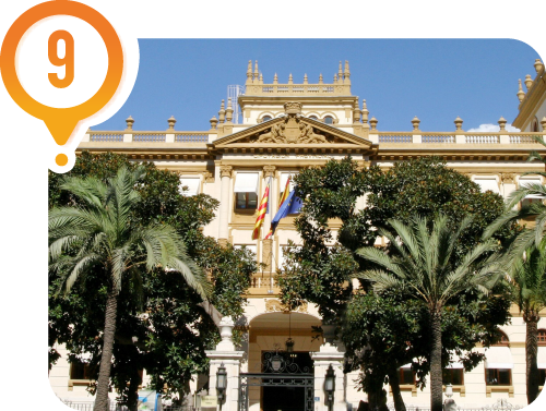
Alicante Provincial Council

The palace of the Alicante Provincial Council was built in the 1930s. This building highlights the significance of the avenue that connected the train station to what was then the city downtown. The avenue ends at the train station where the Queen arrived in 1858 to inaugurate the railway line. Although the original station facade has not been preserved, its cast iron roof remains intact. Now we are going to explore some streets of the city downtown. This walk will take you through some of Alicante’s most iconic streets, leading us back to our starting point.

RUTA

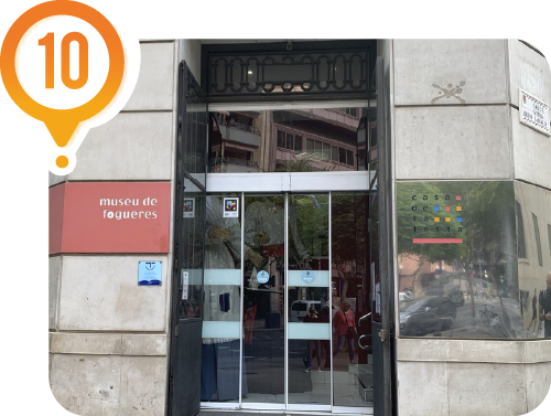
Fogueres Museum

The Fogueres Museum of Alicante (Museo de Fogueres de Alicante) is a unique space that showcases the different stages in the evolution of the city’s most iconic festival, which is held in June: Les Fogueres de Sant Joan, a celebration recognized as a Festival of International Tourist Interest. Just a five-minute walk from this museum, you’ll find the Plaza de Toros, which also houses the Alicante Bullfighting Museum (Museo Taurino de Alicante).

RUTA

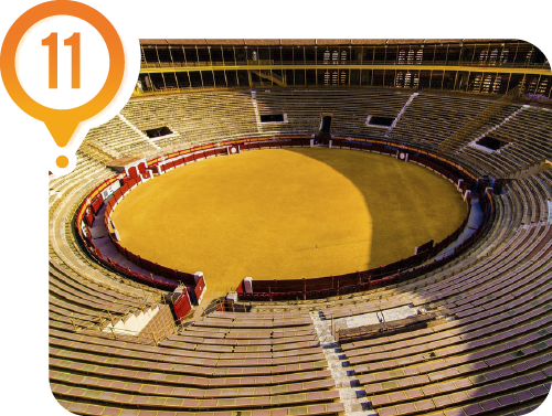
The Bullring and Bullfighting Museum

It is one of the oldest bullrings in the Valencian Community that is still in operation. Built in 1847 by the Alicante architect Emilio Jover, it was renovated in 1884 due to deterioration. The greatness of the bullring and its large capacity reflects the significance of bullfighting in Alicante during the 19th and 20th centuries. Inside the Alicante Bullring (Plaza de Toros de Alicante), this museum offers a comprehensive display of bullfighting. Its rooms host a permanent exhibition of Alicante bullfighters such as Vicente Blau, Jose Maria Manzanares, Francisco Anton, and Luis Francisco Espla—free access to the Museum.

RUTA

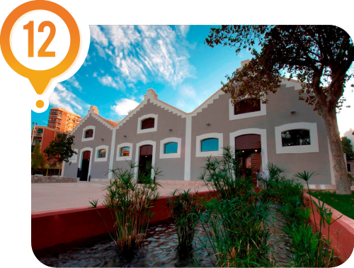
Las Cigarreras Cultural Center

Located in one of the city’s most iconic buildings, the former Tobacco Factory (Fabrica de Tabacos), this space — situated in one of the three warehouse halls of the factory and with almost 3,000 m² — is the result of the project promoted by the Alicante Town Hall and Alicante Cultura. It serves as a multicultural center, a spot for interaction, dialogue, creation, and the showcase of contemporary art in all its forms. A place where multidisciplinary works come together and are projected with a plural, active, and fluid vision.

ROUTE

The Bullring and Bullfighting Museum

It is one of the oldest bullrings in the Valencian Community that is still in operation. Built in 1847 by the Alicante architect Emilio Jover, it was renovated in 1884 due to deterioration. The greatness of the bullring and its large capacity reflects the significance of bullfighting in Alicante during the 19th and 20th centuries. Inside the Alicante Bullring (Plaza de Toros de Alicante), this museum offers a comprehensive display of bullfighting. Its rooms host a permanent exhibition of Alicante bullfighters such as Vicente Blau, Jose Maria Manzanares, Francisco Anton, and Luis Francisco Espla—free access to the Museum.

ROUTE

Fogueres Museum

The Fogueres Museum of Alicante (Museo de Fogueres de Alicante) is a unique space that showcases the different stages in the evolution of the city’s most iconic festival, which is held in June: Les Fogueres de Sant Joan, a celebration recognized as a Festival of International Tourist Interest. Just a five-minute walk from this museum, you’ll find the Plaza de Toros, which also houses the Alicante Bullfighting Museum (Museo Taurino de Alicante).

ROUTE

Alicante Provincial Council

The palace of the Alicante Provincial Council was built in the 1930s. This building highlights the significance of the avenue that connected the train station to what was then the city downtown. The avenue ends at the train station where the Queen arrived in 1858 to inaugurate the railway line. Although the original station facade has not been preserved, its cast iron roof remains intact. Now we are going to explore some streets of the city downtown. This walk will take you through some of Alicante’s most iconic streets, leading us back to our starting point.

ROUTE

Plaza de Los Luceros

We walked along the Avenida Alfonso X el Sabio which ends at the Plaza de los Luceros, one of the most important squares in the city. Beneath this square, we currently find one of the TRAM stops (metropolitan public transport of Alicante), which allows us to conveniently visit San Juan Beach or explore many tourist towns along the northern coast of the province. The square was built in the early 20th century, but it holds significance for another reason: the city needed urban planning to construct new buildings after the city walls were demolished. Using the square as a central axis, the main avenues were developed. We will take one of these avenues to reach our next stop.

ROUTE

Alicante Central Market

The current Central Market is located on Avenida Alfonso X el Sabio, named after the king who conquered the city from the Muslims in the 13th century. This was the most vibrant area at the time and remains one of the main avenues of the city. This building was built at the beginning of the 20th century and was bombed during the Civil War.

ROUTE

Avenida de la Constitución

The entertainment area moved to this region when Alicante began to grow. Here the main buildings of the time were created: the Casa de Socorro, also known as Cine Ideal, was the only surviving structure in the city from the golden age experienced by movie theaters in the 1920s, when they became the favorite pastime of an industrial society.

ROUTE

Principal Theater of Alicante

The construction of this new theater in the mid-19th century had two important effects: the affirmation of an ascending social class of merchants who gifted the city its most important public work of the century and solidified an emerging urban structure that served as a bridge between the 18th-century walled city and the new city expansion of the late 19th century. It is a characteristic example of the long series of theaters that were being built in the country at that time. The interior is a representation of the typical Italian-style theater with a horseshoe-shaped floor.

ROUTE

Plaza Gabriel Miro

This area already had buildings before the demolition of the city walls, but it began to acquire its current shape in the 19th century. This square, formerly known as “Plaza de las Barcas”, represents the embodiment of the bourgeois city and the idea of urban beautification of the new ruling class. At the same time as this square was being developed, other squares were constructed across the city, driven by the same desire to beautify Alicante. The current fountain was installed to commemorate the bringing of water from a nearby town in the province in 1898 given the existing need for water supply in Alicante.

ROUTE

Rambla Mendez Nuñez

This avenue marks the boundary that used to and still does distinguish the old town from the historic downtown (which was yet to emerge). It was the old moat of the wall, where rainwater flowed. For years, the city had barely expanded beyond the rambla, as it served as a natural boundary that the inhabitants preferred not to cross. When the city no longer had space to grow, it was decided to start building on the other side of the rambla.

ROUTE

Plaza Puerta del Mar

Alicante was a walled city until the 19th century. In 1858, Queen Isabel II came to Alicante to inaugurate the train connecting the city to Madrid. Taking advantage of this occasion and considering that the city could no longer expand due to its walls, permission was requested from the queen to demolish them. This is how the city began to expand. On this route, we will explore the area where the new city emerged in the second half of the 19th century.

ROUTE

Explanada de España

We must walk along the Explanada to reach this expansion. This promenade was one of the first to be built at the end of the 19th century. After the walls were demolished, the rubble was used to fill the land and create this promenade. Initially, it was called “El Malecon” and later it was renamed to “Paseo de los Martires de la Libertad”. The current esplanade was built in the 1960s and has a total of 6,600,000 tiles. Three colors can be observed, one of which is called Alicante red, a marble color that is only extracted in this area, from there its name.

This site is registered on wpml.org as a development site. Switch to a production site key to remove this banner.