ROUTE:
1.57 km
DURATION:
2 hours
DIFFICULTY:
Easy
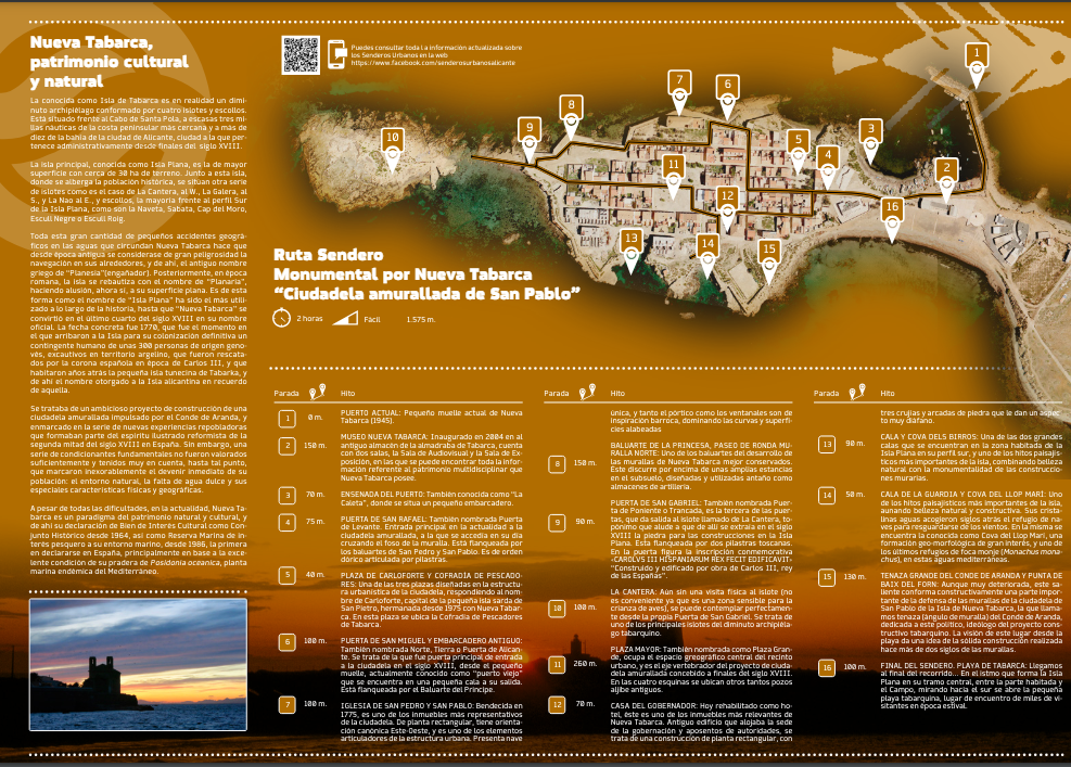
Nueva Tabarca, cultural and natural heritage
Commonly referred to as Tabarca Island, this location is a small archipelago consisting of four islets and rocks. It is situated off the coast of Cabo de Santa Pola, just three nautical miles from the nearest mainland coast and more than ten from the bay of the city of Alicante, a city to which it has administratively belonged since the end of the 18th century.
The main island, known as Isla Plana, is the largest in area with about 30 ha of land. Next to this island, where the historic population is housed, there are other islets such as La Cantera, to the West, La Galera, to the South, and La Nao, to the East, and rocks, most of them off the southern profile of Isla Plana, such as Naveta, Sabata, Cap del Moro, Escull Negre or Escull Roig.
Trail Stops
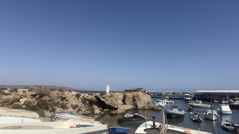
1. Current port
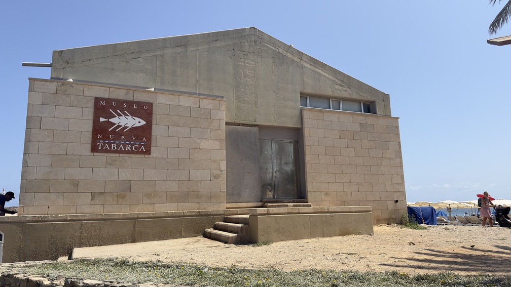
2. New Tabarca Museum
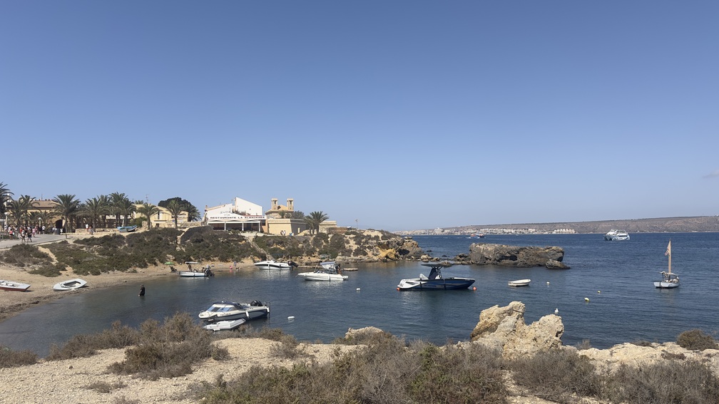
3. Port cove
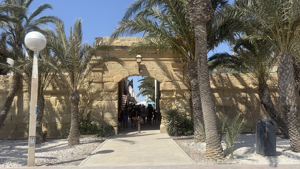
4. San Rafael Gate
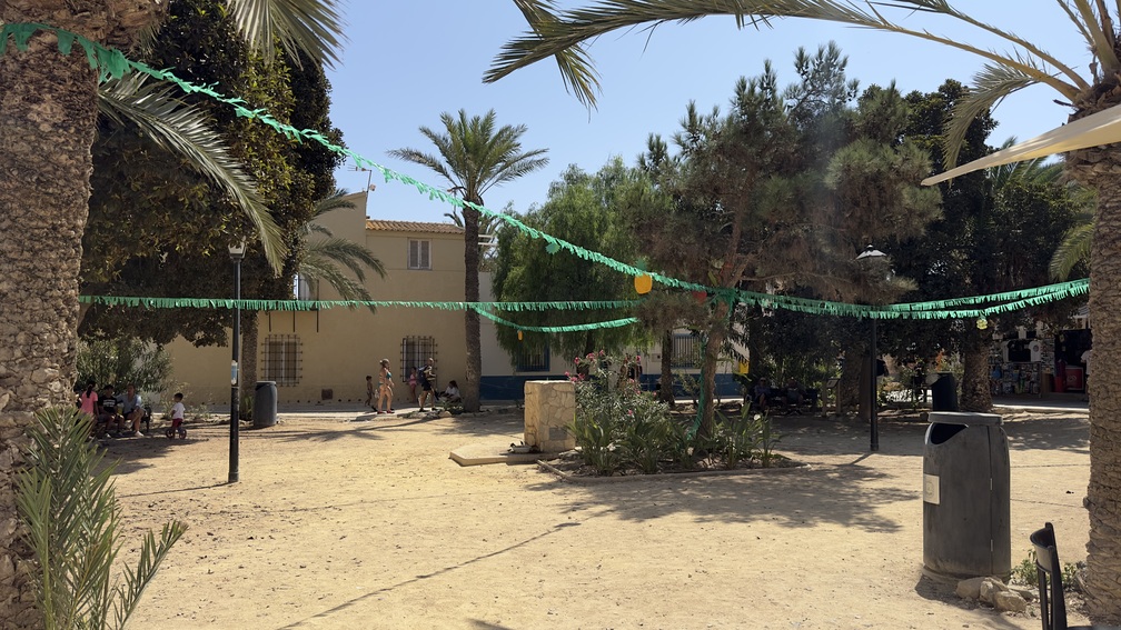
5. Carloforte Square and fishermen's guild
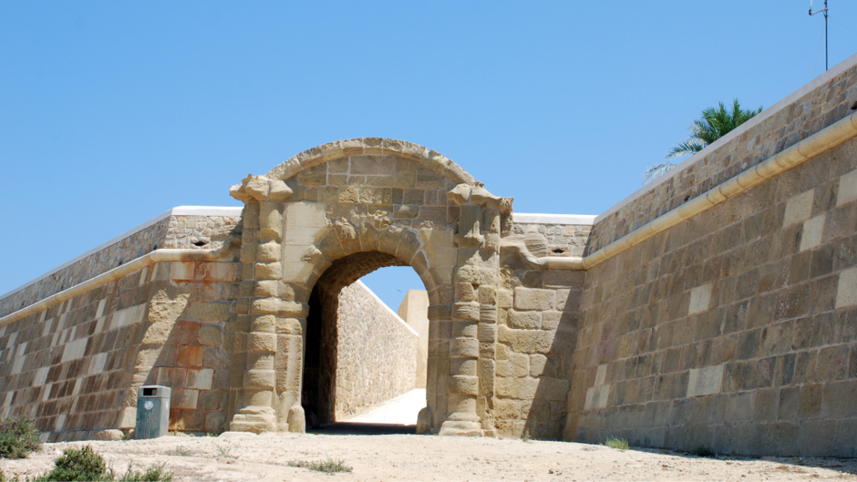
6. San Miguel Gate and old pier
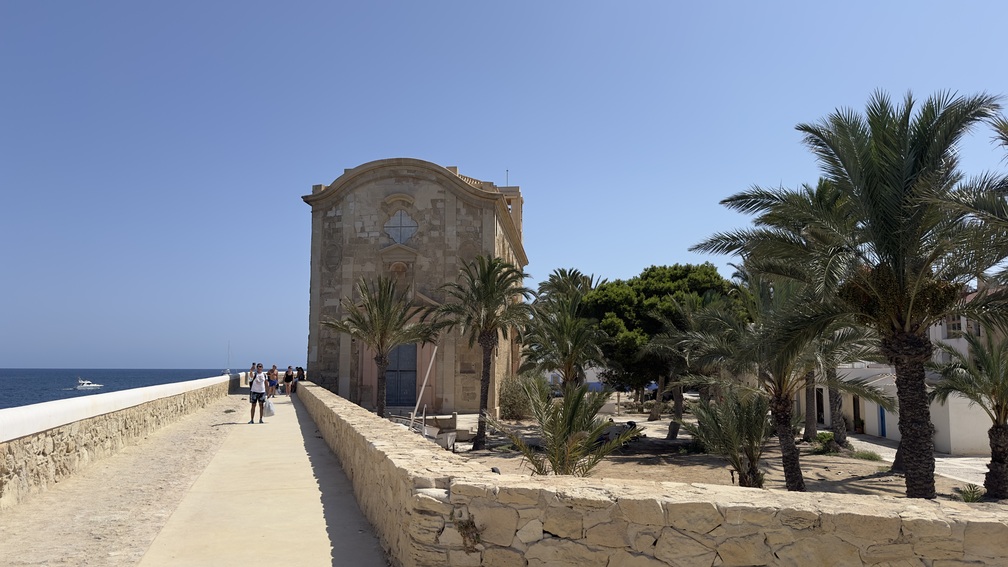
7. Church of San Pedro and San Pablo
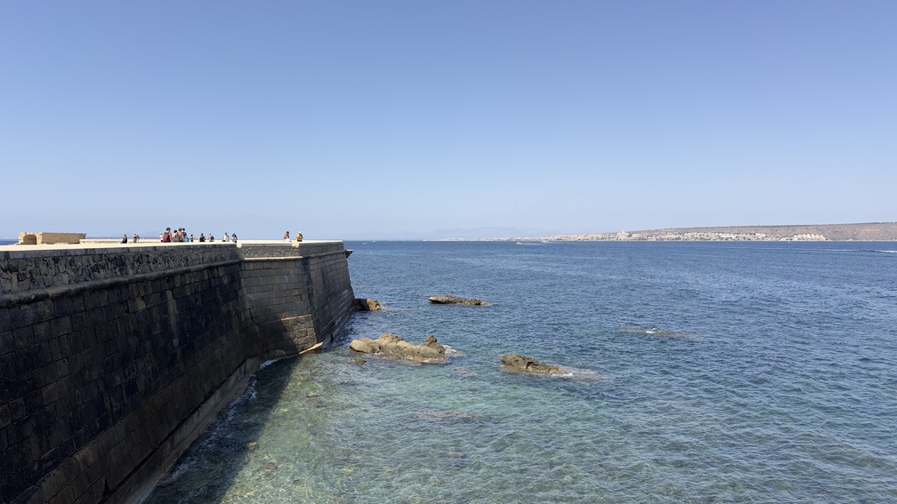
8. Princess Bastion, north wall promenade
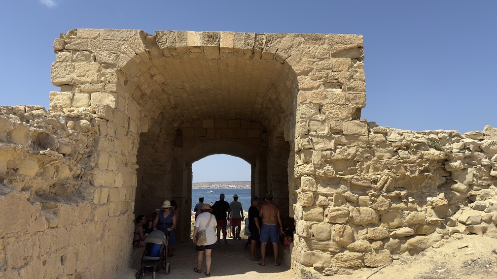
9. San Gabriel Gate
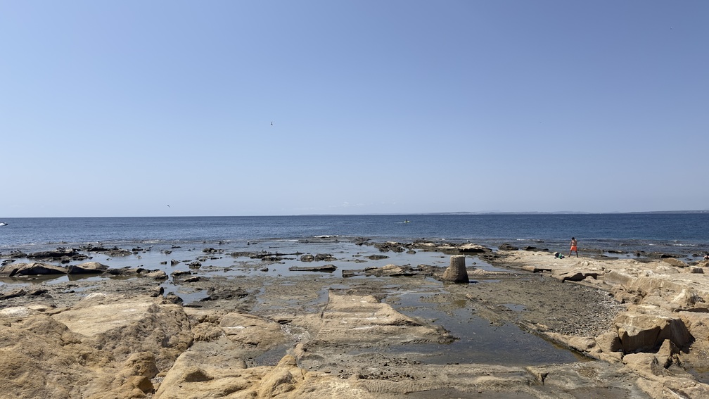
10. The Quarry

11. Main Square
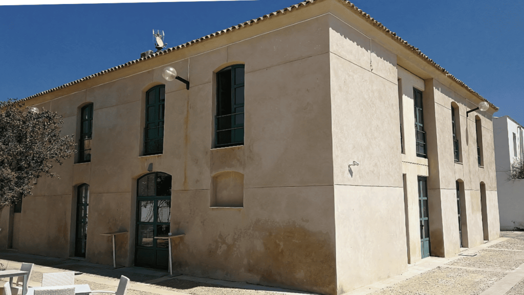
12. Governor's House
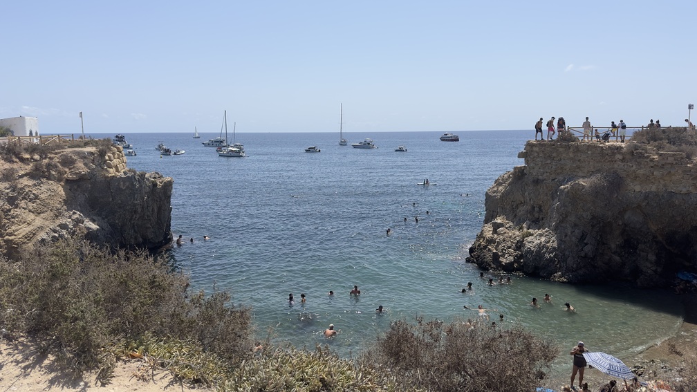
13. Dels Birros Cove and Cave

14. Guardia Cove and Llop Mari Cave
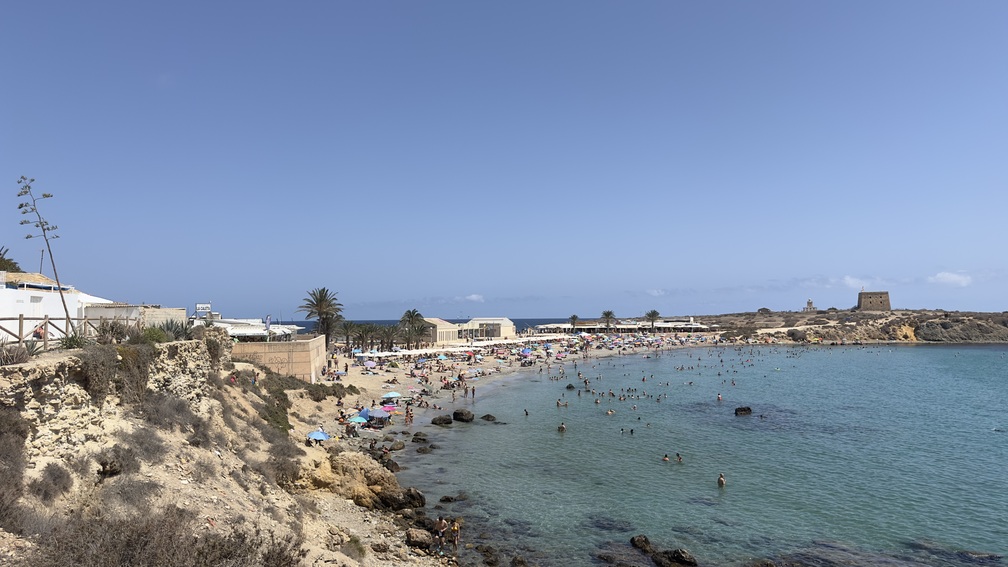
15. Large Tenaza of the Count of Aranda and Baix del Forn Point
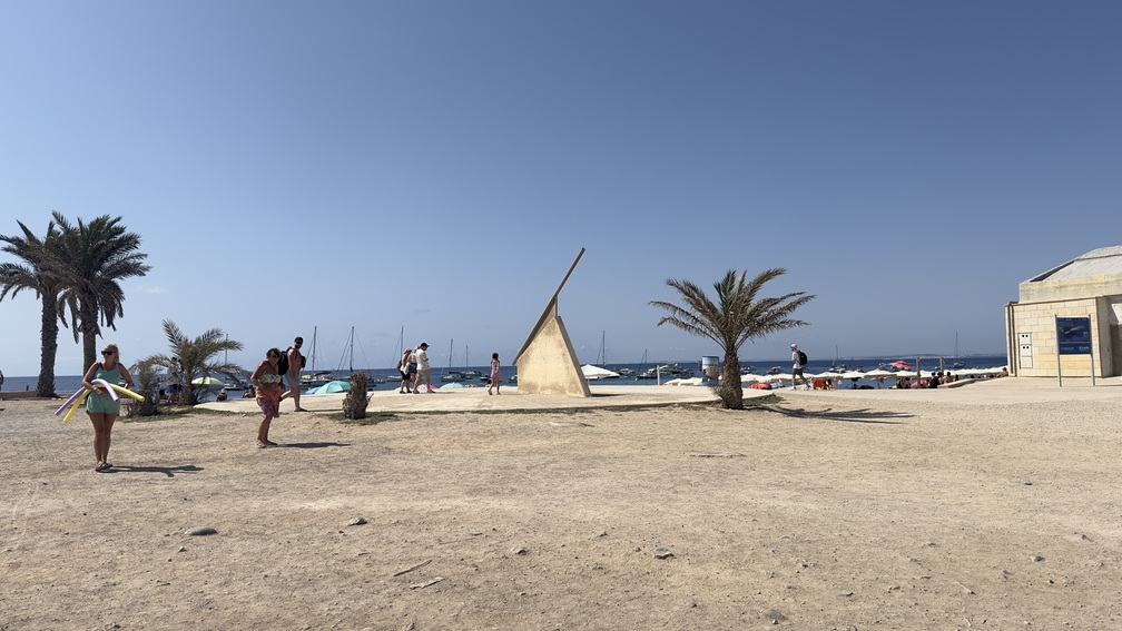
16. End of the trail. Tabarca Beach
All Routes in Alicante
Services that might interest you
| EMPRESAS |
|---|
| AGUITUR +34 634 580 675 info@guiasoficialescv.com www.guiasoficialescv.com/ Guías de Turismo acreditados por la Agencia Valenciana de Turismo Tourist guides accredited by the Valencian Agency of Tourism |
| ALACANT CIRCUIT +34 601 039 933 +34 685 829 937 info@alacantcircuit.com www.alacantcircuit.com Guías de Turismo acreditados por la Agencia Valenciana de Turismo Tourist guides accredited by the Valencian Agency of Tourism |
| BLUEMED TOURS S.L C/ Pintor Aparicio, 28 E-1, 03003, Alicante +34 679 899 880 central@bluemedtours.com www.bluemedtours.com Distintivo SICTED L’Exquisit Mediterrani CREATURISME COMUNIDAD VALENCIANA CULTURAL CRATURISME COMUNIDAD VALENCIANA ENOTURISMO CONVENTION BUREAU ALICANTE RUTA DEL VINO ALICANTE Guías de Turismo acredidatos por la Agencia Valenciana de Turismo Tourist guides accredited by the Valencian Agency of Tourism Idiomas/ Languages: English, Español, Français, Valencià |
| Esatur XXI, S.L. Calle Arzobispo Loaces, 3, 03003, Alicante +34 966 377 034 info@esatur.com www.estaturservicios.com Distintivo SICTED ISO 9001 ISO 14001 ISO 27001 Guías de Turismo acredidatos por la Agencia Valenciana de Turismo Tourist guides accredited by the Valencian Agency of Tourism Idiomas/ Languages: English, Español, Valencià |
| FREE WALKING TOURS ALICANTE +34 616 750 608 freewalkingtoursalicante@gmail.com www.freewalkingtoursalicante.com Guías de Turismo acreditados por la Agencia Valenciana de Turismo Tourist guides accredited by the Valencian Agency of Tourism |
| OXYTOURS +34 693 701 596 hola@oxytours.com www.oxytours.com Guías de Turismo acredidatos por la Agencia Valenciana de Turismo Tourist guides accredited by the Valencian Agency of Tourism |
| TRAMUNTANA AVENTURA C/ Rabasa, 3, Local 1, 03005, Alicante +34 686 216 102 info@tramuntanaaventura.es www.tramuntanaventura.es Certificado Q de Calidad Turística Certificado Sicted Guías de Turismo acredidatos por la Agencia Valenciana de Turismo Tourist guides accredited by the Valencian Agency of Tourism |
| TURIGUIAS C/ del Teatro 41, 4 IZQ, 03001, Alicante +34 686 469 916 +34 654 486 777 contact@turiguiasalicante.com www.turiguiasalicante.com Certificado de calidad SICTED Guías de Turismo acredidatos por la Agencia Valenciana de Turismo Tourist guides accredited by the Valencian Agency of Tourism |
| ULA Guides Marina Deportiva, Mlle. Levante, 6, 03001, Alicante +34 677 299 150 ula_sp@hotmail.com Distintivo SICTED Guías de Turismo acredidatos por la Agencia Valenciana de Turismo Tourist guides accredited by the Valencian Agency of Tourism Idiomas/ Languages: Deutsch, English, Español, Français, Italiano, Valencià, otros |
| EMPRESAS |
|---|
| Alicante By Bike & Rentals Tours C/ Cienfuegos, 1, 03002, Alicante +34 605 097 063 info@alicantebybike.com www.alicantebybike.com |
| Bike Rent in Alicante C/ Bailén, 14, Local 1, 03001, Alicante +34 605 657 496 |
| Blue Bike | Rental & Tour C/ Mayor 45, 03002, Alicante info@bluebike.es www.bluebike.es |
| Rent Point- Rent Bike Alicante C/ Navas 11, 03001, Alicante +34 658 348 218 rentpointalicante@gmail.com www.rentpointalicante.com |
| Bikes&City Alicante – Alquiler, rutas C/ San Vicente 61, 03004, Alicante +34 966 376 596 www.bikesandcity.com |
| EMPRESAS |
|---|
| BLUE BIKE ALICANTE C/ Mayor, 45, 03002, Alicante +34 674 676 362 www.bluebike.es |
| ESATUR +34 966 377 034 www.alicantesmartdestination.com |
| SEGWAY ALICANTE +34 656 332 485 +34 966 272 837 |
| SIS TOURS EVENTS 627 955 608 info@sistoursevents.com www.sistoursevents.com |
| TRAMUNTANA AVENTURA C/ Rabasa, 3, 03005, Alicante +34 686 216 102 +34 616 35 1506 info@tramuntanaaventura.es www.tramuntanaaventura.es |
| EMPRESAS |
|---|
| AKRAVIBE C/ Castaños, 42, 03003, Alicante +34 965 168 907 www.akravibe.es |
| AVENTURERO CATAMARÁN S.L Av. Conde de Vallellano, s/n, 03001, Alicante +34 694 443 820 info@alicantecatamaran.com www.alicantecatamaran.com |
| ALICANTE RACING QUADS RENT Mlle. Poniente, 6, 03001, Alicante +34 697 207 904 alicanteracingquads@gmail.com |
| ALIJETSET Mlle. Levante, 8, Local 4, 03001, Alicante +34 627 031 220 +34 660 731 819 info@alijetset.com www.alijetset.com |
| AWANA Av. Condomina 70 BL5 E15, 03540, Alicante +34 636 852 977 info@awanamountains.com www.awanamountains.com |
| BLUE VALLEY Av. Costa Blanca, 114, 03540, Alicante +34 635 230 672 +34 645 392 021 info@bluevalleyco.com |
| CENTRO BUCEO ALTAIR C/ Rosa Chacel, 20 local D, 03008, Alicante +34 634 959 013 buceoaltair@gmail.com www.alicantebuceo.es |
| CLUB DE SURF EL MORENO C/ Deportista Juan Mato, 4, 03016, Alicante +34 649 556 696 elmorenosurf@gmail.com www.clubsurfelmoreno.com |
| EPICALBOATS Marina Deportiva, 03001 Alicante +34 605 729 918 info@epicalboats.es www.epicalboats.es |
| ENERGY ACTIVE CLUB Av. de la Costa Blanca, 114, 03540, Alicante +34 635 230 672 www.energyactiveclub.com |
| FANAUTIC CLUB ALICANTE C/ Currica, 1, 03590, Alicante +34 639 661 398 alicante@fanauticclub.com www.fanauticclub.com |
| HIKINGALICANTE C/ Miraflor 1, 03005, Alicante +34 660 507 225 info@hikingalicante.com hikingalicante.com |
| LLOGA UN LLAÜT Mlle. de Levante 8, s/n, 03113, Alicante +34 680 191 313 info@llogaunllaut.es www.llogaunllaut.es |
| MARINA JETS S.L Mlle. de Levante Tinglado 21A, 03002, Alicante +34 602 585 243 marinajets.sl@gmail.com |
| OXYTOURS +34 693 701 596 hola@oxytours.com www.oxytours.com |
| PARASAILING ALICANTE Mlle. 14, Zona de Levante, S/N, 03001, Alicante +34 674 444 747 info@parasailingalicante.com reservas@parasailingalicante.com www.parasailingalicante.com |
| SIS TOURS EVENTS Av. Miriam Blasco, 2, 03540, Alicante +34 627 168 907 +34 609 291 993 info@sistorsevents.com www.sistoursevents.com |
| TRAMUNTANA AVENTURA C/ Segura, 13, Bajo derecha, 03004, Alicante +34 686 216 102 info@tramuntanaaventura.es www.tramuntanaventura.es |
| EMPRESAS |
|---|
| ALICANTE RACING QUADS RENT C/ de Sant Agustí, 3, 03002, Alicante +34 697 207 904 alicanteracingquads@gmail.com |
| OXYTOURS +34 693 701 596 hola@oxytours.com www.oxytours.com |
| TRAMUNTANA AVENTURA C/ Rabasa, 3, 03005, Alicante +34 686 216 102 +34 616 35 1506 info@tramuntanaaventura.es www.tramuntanaaventura.es |


