Cabo de la Huerta

ROUTE:

4.35 km

DURATION:

2 hours 30 minutes

DIFFICULTY:

Easy
The ancient Cap de l’Alcodre

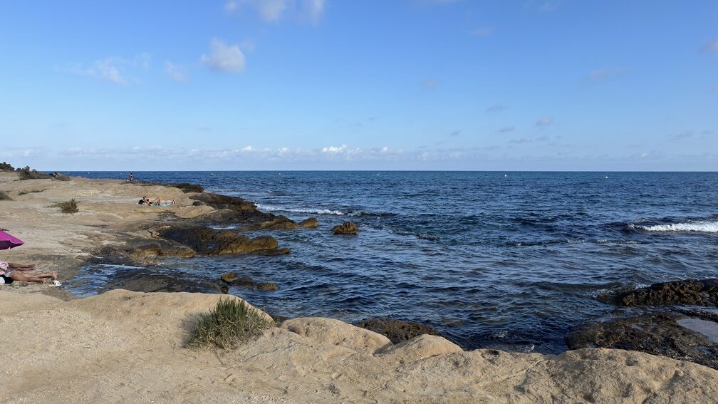
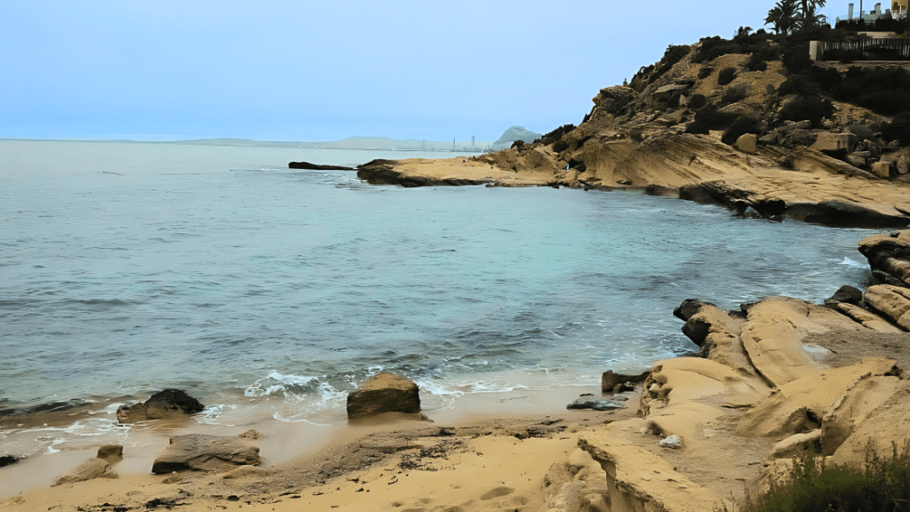
Cabo de la Huerta lies northeast of Alicante Bay, between the beaches of Albufereta and San Juan. Its name comes from the now-lost Alicante farmland, which was irrigated by water from the Monnegre river. After the Embalse de Tibi was built in the late 16th century, irrigation expanded using a system of canals, reaching nearby areas like La Condomina. However, this cape was originally known as l’Alcodre, from the Arabic al-kodra, meaning “the green,” which eventually evolved into its current name.

Geologically, the rocky substrate of the Cabo de la Huerta is composed of yellowish sandstones deposited about 8 million years ago (Upper Miocene) on a shallow marine continental shelf. They contain fossils of sea urchins and bivalves, with trace fossils being very common. Above the Miocene sandstones, horizontal layers of Quaternary micro-conglomerates can be seen in some areas. These are remnants of a marine terrace, considered a “fossil beach” from about 100,000 years ago.

Trail Stops
All Routes in Alicante

Route A

Maritime facade of Alicante

Route B

Santa Barbara Castle

Route C

Old Town of Alicante

Route D

The Traditional Downtown of Alicante

Route E

Alicante Air Raid Shelters

Services that might interest you

Events calendar

No event found!

The Cabo de la Huerta has very particular terrestrial vegetation adapted to the characteristics of the environment, such as the sea daisy (Asteriscus maritimus), the fine-leaved crown (Coronilla juncea), or the sea fennel (Crithmum maritimum), highlighting some endemisms of the province of Alicante such as the Senecio auricula and, above all, the Alicante everlasting (Limonium furfuraceum).

As for the marine vegetation, along the shore or among the rocks, remains of Posidonia oceanica and some algae can be easily detected. The Posidonia is a plant endemic to the Mediterranean and has notable ecological importance as it forms submarine meadows, constitutes the climax community of the Mediterranean Sea, and plays a considerable role in the protection of the coastline against erosion.

Regarding the fauna, we can distinguish species of coastal or marine birds such as the great cormorant (Phalacrocorax carbo), the Audouin’s gull (Larus audouinii), and the sandwich tern (Sterna sandvicensis). In addition, the presence of other water-related birds can be observed such as the little egret (Egretta garzetta), the kentish plover (Charadrius alexandrinus), the ruddy turnstone (Arenaria interpres), and the whimbrel (Numenius phaeopus).

The urban pressure of the last 30 years caused the Cape to undergo a significant transformation. However, possibly due to the orography, some areas partially escaped urbanization preserving their environmental value. Currently, Cabo de la Huerta has a flora micro-reserve in Cala Cantalares and is part of the Sites of Community Importance (SCI) of the Valencian Community proposed in the Natura 2000 Network (European Union), protecting the Posidonia oceanica meadows and the high-quality rocky seabeds.

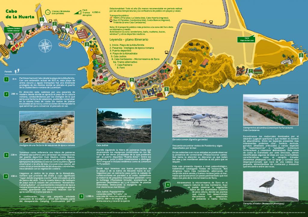
1. Albufereta Beach

0 meters

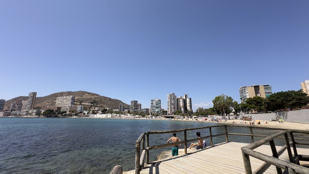
We depart for the Cape from Albufereta Beach. Stretching 423 meters, this beach of dark sand and calm waters was once a sheltered cove that served as the port for the Iberian-Roman city of Lucentum.

2. Remains from the Roman period

200 meters

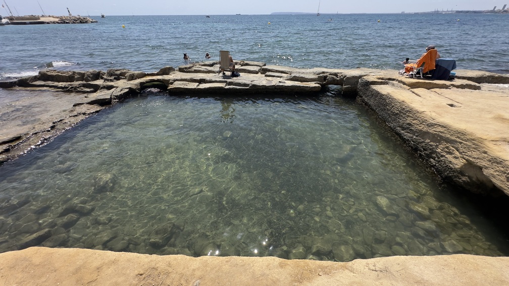
Heading east, we climb a wooden walkway, where remnants of Roman culture can be seen. The path leads us past the ruins of a seaside villa, and along the coastline, we can spot the remains of a Roman fish nursery.

3. Marina

220 meters

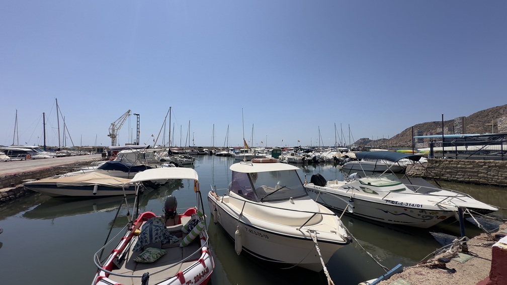
Using a row of palm trees (Phoenix dactylifera) as a guide, we pass through the Costa Blanca Yacht Club. Along the way, invasive plants like agave (Agave americana) and ice plant (Carpobrotus edulis) mingle with local coastal vegetation.

4. Almadraba Beach

430 meters

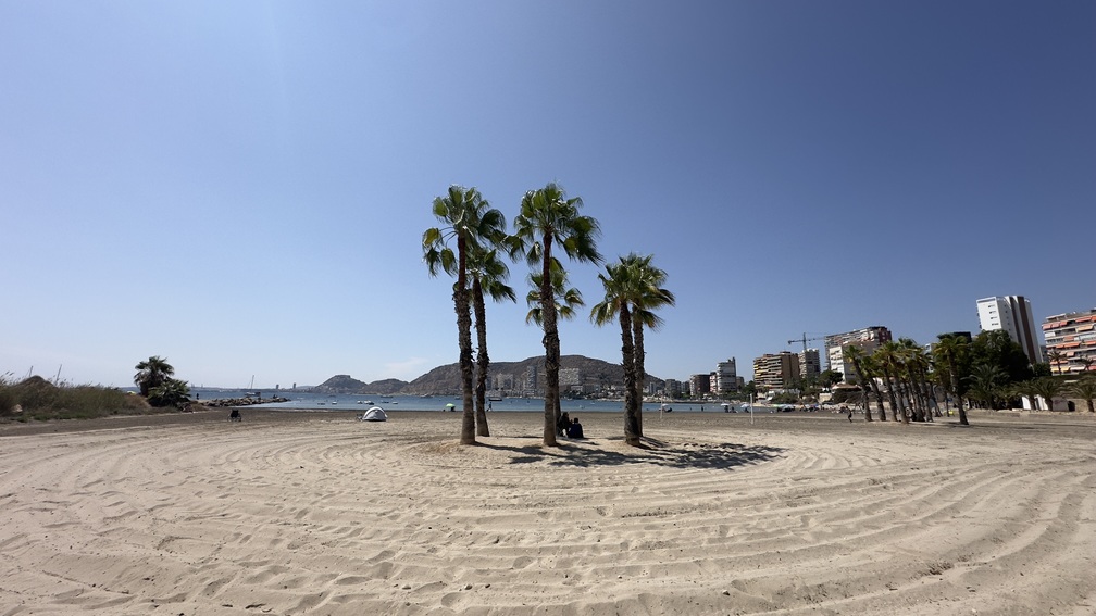
We arrive at Almadraba Beach, a name derived from Arabic meaning “place of striking or fighting,” linked to traditional tuna fishing. Behind the white beach first aid hut lies the fenced-off archaeological site of “Almadraba Camping Bahía,” an industrial settlement from the Roman Imperial period, with barely visible remains closely related to the ones at Stop 2. Nearby is a small grove of eucalyptus and pine trees, once part of a now-defunct campsite. Continuing along a low wall lined with palm trees, we reach breakwaters built in the 1980s, remnants of the halted “Puerto Amor” marina project. Here, we start to see unique and even endemic plants like Limonium furfuraceum. From this point, there’s a beautiful view of the beach and Alicante Bay to the south. We follow a narrow path alongside fenced-off properties, where low shrubs such as Thymelaea hirsuta thrive, accompanied by wildflowers like Asphodelus sp. and bright coastal plants, including the sea daisy (Asteriscus maritimus).

5. Cala Judios

1200 meters

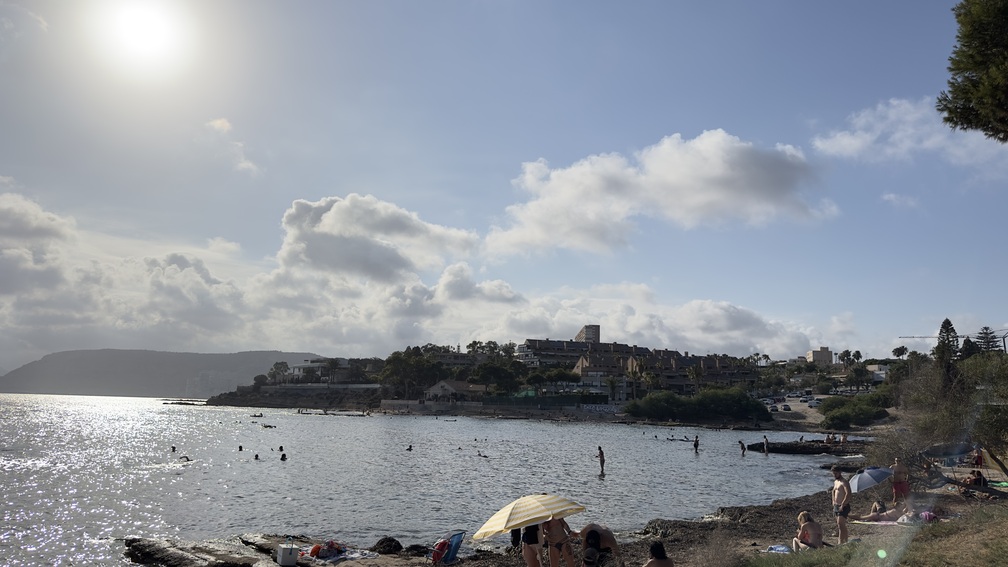
Cala Judios. Popularly known as “La Calita,” this small cove is just 200 meters long, with dark sand and rocky areas. It’s common to find remnants of Posidonia and algae washed ashore. On rocky outcrops, you might spot cormorants (Phalacrocorax carbo) resting with their wings outstretched to dry in the sun. The cove is also paleontologically rich, with cataloged mollusk fossils. We continue to Cala Cantalares, alternating between paths and rocky trails along the sea, until reaching a paved walkway that leads to the micro-reserve of flora.

6. Cala Cantalares

650 meters

We pass through the micro-reserve of flora in the natural area of Cala Cantalares.
Here, we will find typical vegetation of low coastal cliffs, with plants adapted to the salty marine environment. Shrubs dominated by Lygeum spartum form habitats called “albardinares.” Noteworthy species include Senecio auricula, Anabasis articulata, Limonium furfuraceum, and various types of “saladillas” (Limonium delicatulum). This coastal area is frequented by wading birds, including the curlew (Numenius phaeopus), easily identified by its long, curved beak. It feeds on crustaceans and mollusks among the rocks. From here we ascend a few meters along a path that progressively acquires a steeper profile, taking as a reference the cairns that delimit the coast, leading us through an enveloping landscape resulting from erosion on the limestone rocks.

Alternative route

This half-kilometer stretch leads to a natural space between the micro-reserve and the garden by the sundial known as “El Barquito,” connecting to Avenida Costa Blanca. Forest restoration efforts in the area have combined Mediterranean shrubs with isolated pines (Pinus halepensis). At the top, a wooden-marked path leads to a viewpoint offering diverse panoramas.

7. Cala Palmera

1000 meters

We have walked through an area next to coastal platforms where we can see the little egret (Egretta garzetta) stirring the silt with its feet to bring out fish and crustaceans. On the platforms adjacent to Cala Palmera, we can easily identify fossil traces and appreciate the contrast of the surfaces covered with a mantle formed by green algae (Chlorophyta) such as Ulva compressa. Heading towards the lighthouse, we continue along the upper path following the metal fence that borders it, passing by an old quarry.

8. Lighthouse

650 meters

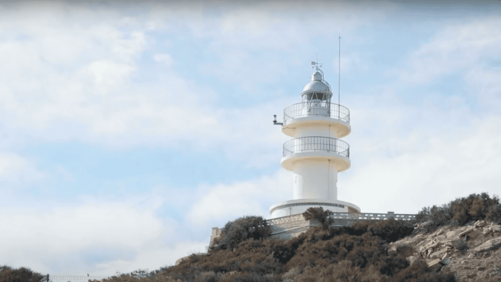
We are located under the lighthouse, one of the last inhabited by lighthouse keepers in the province of Alicante. This circular lighthouse and cylindrical volume stands on the remains of the watchtower of l’Alcodre which was built in the 16th century with the main mission of watching the arrival of Barbary pirates. We descend towards the easternmost tip of the Cape, leaving behind us a small cliff, finding an ideal place to observe the curious geomorphology of the area, appreciating the cracks and bars that have a jagged appearance on the coast, with inlets where the strata of calcarenites are less resistant. Opposite, on isolated rocks, it is common to find the occasional cormorant (Phalacrocorax carbo) in the company of groups of Audouin’s gulls (Larus audouinii). From here we have a good perspective of the beach of San Juan towards El Campello and, as a whole, a panoramic view of the Alicante mountains: the Cabeço d’Or, Aitana, the Puig Campana, the Serra Gelada, and the island of Benidorm at the east end.

A few meters from the Lighthouse, in the direction of San Juan beach, our trail ends at a clear example of angular unconformity, a stratigraphic discontinuity that separates a lower rock assemblage belonging to the Upper Miocene (between 8 and 10 million years old) from an upper one from the Quaternary, with marine sediments of what would be a fossil beach from 100,000 years ago (Tyrrhenian).

The Cabo de la Huerta has very particular terrestrial vegetation adapted to the characteristics of the environment, such as the sea daisy (Asteriscus maritimus), the fine-leaved crown (Coronilla juncea), or the sea fennel (Crithmum maritimum), highlighting some endemisms of the province of Alicante such as the Senecio auricula and, above all, the Alicante everlasting (Limonium furfuraceum).

As for the marine vegetation, along the shore or among the rocks, remains of Posidonia oceanica and some algae can be easily detected. The Posidonia is a plant endemic to the Mediterranean and has notable ecological importance as it forms submarine meadows, constitutes the climax community of the Mediterranean Sea, and plays a considerable role in the protection of the coastline against erosion.

Regarding the fauna, we can distinguish species of coastal or marine birds such as the great cormorant (Phalacrocorax carbo), the Audouin’s gull (Larus audouinii), and the sandwich tern (Sterna sandvicensis). In addition, the presence of other water-related birds can be observed such as the little egret (Egretta garzetta), the kentish plover (Charadrius alexandrinus), the ruddy turnstone (Arenaria interpres), and the whimbrel (Numenius phaeopus).

The urban pressure of the last 30 years caused the Cape to undergo a significant transformation. However, possibly due to the orography, some areas partially escaped urbanization preserving their environmental value. Currently, Cabo de la Huerta has a flora micro-reserve in Cala Cantalares and is part of the Sites of Community Importance (SCI) of the Valencian Community proposed in the Natura 2000 Network (European Union), protecting the Posidonia oceanica meadows and the high-quality rocky seabeds.

8. Lighthouse

650 meters

We are located under the lighthouse, one of the last inhabited by lighthouse keepers in the province of Alicante. This circular lighthouse and cylindrical volume stands on the remains of the watchtower of l’Alcodre which was built in the 16th century with the main mission of watching the arrival of Barbary pirates. We descend towards the easternmost tip of the Cape, leaving behind us a small cliff, finding an ideal place to observe the curious geomorphology of the area, appreciating the cracks and bars that have a jagged appearance on the coast, with inlets where the strata of calcarenites are less resistant. Opposite, on isolated rocks, it is common to find the occasional cormorant (Phalacrocorax carbo) in the company of groups of Audouin’s gulls (Larus audouinii). From here we have a good perspective of the beach of San Juan towards El Campello and, as a whole, a panoramic view of the Alicante mountains: the Cabeço d’Or, Aitana, the Puig Campana, the Serra Gelada, and the island of Benidorm at the east end.

A few meters from the Lighthouse, in the direction of San Juan beach, our trail ends at a clear example of angular unconformity, a stratigraphic discontinuity that separates a lower rock assemblage belonging to the Upper Miocene (between 8 and 10 million years old) from an upper one from the Quaternary, with marine sediments of what would be a fossil beach from 100,000 years ago (Tyrrhenian).

7. Cala Palmera

1000 meters

We have walked through an area next to coastal platforms where we can see the little egret (Egretta garzetta) stirring the silt with its feet to bring out fish and crustaceans. On the platforms adjacent to Cala Palmera, we can easily identify fossil traces and appreciate the contrast of the surfaces covered with a mantle formed by green algae (Chlorophyta) such as Ulva compressa. Heading towards the lighthouse, we continue along the upper path following the metal fence that borders it, passing by an old quarry.

6. Cala Cantalares

650 meters

We pass through the micro-reserve of flora in the natural area of Cala Cantalares.
Here, we will find typical vegetation of low coastal cliffs, with plants adapted to the salty marine environment. Shrubs dominated by Lygeum spartum form habitats called “albardinares.” Noteworthy species include Senecio auricula, Anabasis articulata, Limonium furfuraceum, and various types of “saladillas” (Limonium delicatulum). This coastal area is frequented by wading birds, including the curlew (Numenius phaeopus), easily identified by its long, curved beak. It feeds on crustaceans and mollusks among the rocks. From here we ascend a few meters along a path that progressively acquires a steeper profile, taking as a reference the cairns that delimit the coast, leading us through an enveloping landscape resulting from erosion on the limestone rocks.

Alternative route

This half-kilometer stretch leads to a natural space between the micro-reserve and the garden by the sundial known as “El Barquito,” connecting to Avenida Costa Blanca. Forest restoration efforts in the area have combined Mediterranean shrubs with isolated pines (Pinus halepensis). At the top, a wooden-marked path leads to a viewpoint offering diverse panoramas.

5. Cala Judios

1200 meters

Cala Judios. Popularly known as “La Calita,” this small cove is just 200 meters long, with dark sand and rocky areas. It’s common to find remnants of Posidonia and algae washed ashore. On rocky outcrops, you might spot cormorants (Phalacrocorax carbo) resting with their wings outstretched to dry in the sun. The cove is also paleontologically rich, with cataloged mollusk fossils. We continue to Cala Cantalares, alternating between paths and rocky trails along the sea, until reaching a paved walkway that leads to the micro-reserve of flora.

4. Almadraba Beach

430 meters

We arrive at Almadraba Beach, a name derived from Arabic meaning “place of striking or fighting,” linked to traditional tuna fishing. Behind the white beach first aid hut lies the fenced-off archaeological site of “Almadraba Camping Bahía,” an industrial settlement from the Roman Imperial period, with barely visible remains closely related to the ones at Stop 2. Nearby is a small grove of eucalyptus and pine trees, once part of a now-defunct campsite. Continuing along a low wall lined with palm trees, we reach breakwaters built in the 1980s, remnants of the halted “Puerto Amor” marina project. Here, we start to see unique and even endemic plants like Limonium furfuraceum. From this point, there’s a beautiful view of the beach and Alicante Bay to the south. We follow a narrow path alongside fenced-off properties, where low shrubs such as Thymelaea hirsuta thrive, accompanied by wildflowers like Asphodelus sp. and bright coastal plants, including the sea daisy (Asteriscus maritimus).

3. Marina

220 meters

Using a row of palm trees (Phoenix dactylifera) as a guide, we pass through the Costa Blanca Yacht Club. Along the way, invasive plants like agave (Agave americana) and ice plant (Carpobrotus edulis) mingle with local coastal vegetation.

2. Remains from the Roman period

200 meters

Heading east, we climb a wooden walkway, where remnants of Roman culture can be seen. The path leads us past the ruins of a seaside villa, and along the coastline, we can spot the remains of a Roman fish nursery.

1. Albufereta Beach

0 meters

We depart for the Cape from Albufereta Beach. Stretching 423 meters, this beach of dark sand and calm waters was once a sheltered cove that served as the port for the Iberian-Roman city of Lucentum.

This site is registered on wpml.org as a development site. Switch to a production site key to remove this banner.