Monte Orgegia

ROUTE:

3.5 km

DURATION:

2 hours

DIFFICULTY:

Easy
The Monte Orgegia is located in what was once the agricultural heartland of Alicante. The decline of traditional farming, replaced by industrial agriculture, along with urban growth, led to the gradual abandonment of old agricultural practices. This area was later reforested by the former ICONA organization, leaving some terraced fields in the valleys.

In March 2006, Monte Orgegia was inaugurated as a forest park, becoming the first project of the Metropolitan Forest Plan for the 21st century in the municipality of Alicante. Reforested with around 20,000 Mediterranean trees and shrubs, the park covers an area of 77 hectares. It includes 3 kilometers of trails and two viewpoints that offer stunning views of the l’Alacantí region and the surrounding mountains. To support wildlife recovery, nesting boxes, water feeders, and stone shelters were installed. A water reservoir with a drip irrigation system was also built to conserve the flora.

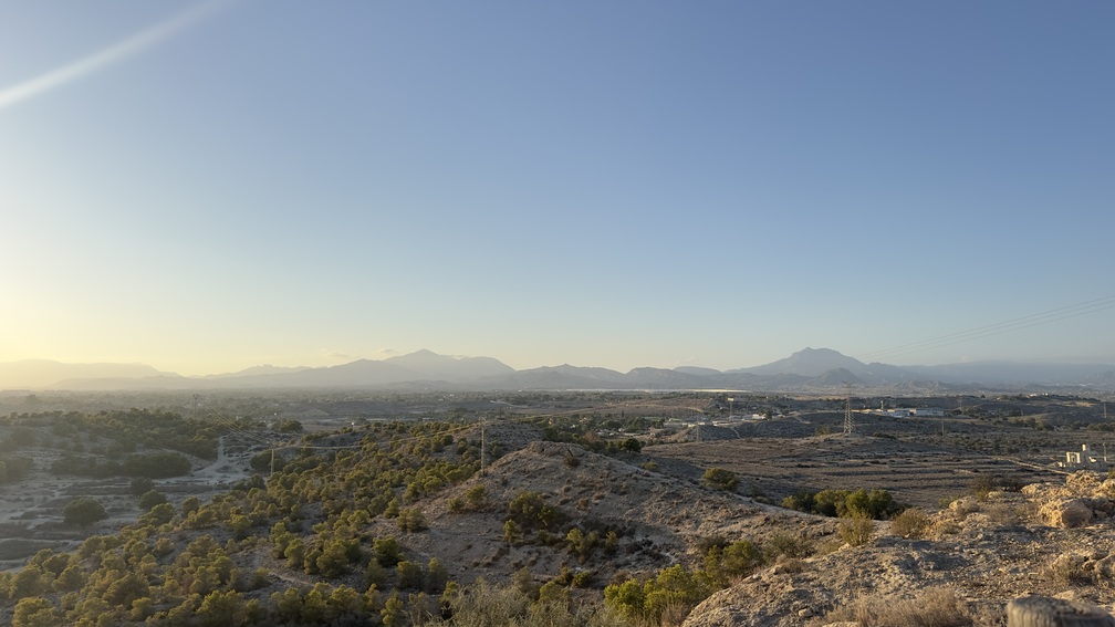
Although Alicante is one of the most mountainous provinces in Spain, with rugged terrain, Monte Orgegia has gentle slopes. From one of the viewpoints, visitors can enjoy a panoramic view of the province’s mountainous landscape, with the nearby mountains marking the boundaries of the l’Alacanti region.

Trail Stops
Natural spaces

How to get there

Access point to the trail via Calle Azafran

BUS: Line 10 to C.C Vistahermosa and 37 minutes on foot to Calle Azafran

All Routes in Alicante

Route A

Maritime facade of Alicante

Route B

Santa Barbara Castle

Route C

Old Town of Alicante

Route D

The Traditional Downtown of Alicante

Route E

Alicante Air Raid Shelters

Services that might interest you

Events calendar

No event found!

The potential flora of Monte Orgegia, based on its climate and soil characteristics, belongs to the semi-arid thermomediterranean series typical of Alicante, with mastic shrubs and dwarf fan palms. However, due to urbanization and soil transformation from farming, the current vegetation is a degraded version of its potential. You’ll find Aleppo pines (Pinus halepensis), which are small due to shallow soil, along with aromatic plants like thyme (Thymus vulgaris) and rosemary (Rosmarinus officinalis). At the base of the mountain, carob trees (Ceratonia siliqua), olive trees (Olea europaea), and almond trees (Prunus dulcis) from abandoned crops. In the ramblas or valleys, the pine forest is denser with abundant shrubbery. As you walk through Monte Orgegia, you’ll also see examples of Alicante’s characteristic thorny vegetation.

Regarding the fauna, in the shrubs and abandoned crops, we find passerine birds (insectivores) such as the white wagtail (Motacilla alba), the great tit (Parus major), the robin (Erithacus rubecula), the serin (Serinus serinus), and the blackbird (Turdus merula). On the rocky areas, we can clearly distinguish the black wheatear (Oenanthe leucura) by its size and shiny black color. Among the raptors that fly over the mountain is the kestrel (Falco tinnunculus) and, already in it, the little owl (Athene noctua) with its undulating flight of rapid wing beats, making continuous descents and ascents.

Small mammals are also common, such as the wild rabbit (Oryctolagus cuniculus), Iberian hare (Lepus granatensis), house mouse (Mus musculus), and European hedgehog (Erinaceus europaeus). On the other hand, as for reptiles, the most representative species are the Iberian wall lizard (Podarcis hispanica), ocellated lizard (Lacerta lepida), Montpellier snake (Malpolon monspessulanus), and ladder snake (Rhinechis scalaris).

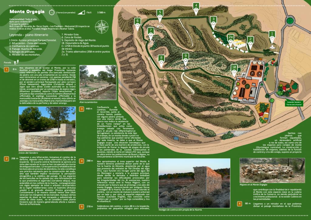
1. Main access Forest Park

0 meters

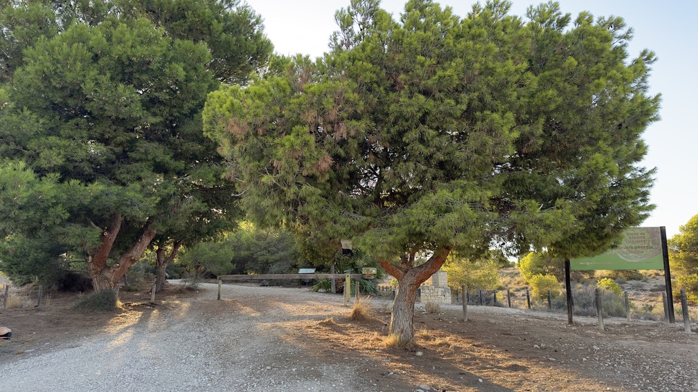
We begin our journey at the entrance to the mountain, on Calle Azafran, behind the Provincial Home. As a starting reference, look for a semicircular stone bench with an ornamental fountain at its center. From here, we’ll ascend a gently sloping path (a 50-meter elevation gain over 1,250 meters to the viewpoint) along the main trail. This path is lined with Aleppo pines (Pinus halepensis), carob trees (Ceratonia siliqua), and a few hackberries (Celtis australis) at the start. The understory includes blackthorn (Rhamnus lycioides), esparto grass (Stipa tenacissima), and aromatic shrubs like rosemary (Rosmarinus officinalis), lavender (Lavandula officinalis), and field chamomile (Arthemis arvensis). The latter resembles chamomile (Matricaria chamomilla) but lacks its delicate fragrance and has a bitter taste.

2. Fork – Terraced area

260 meters

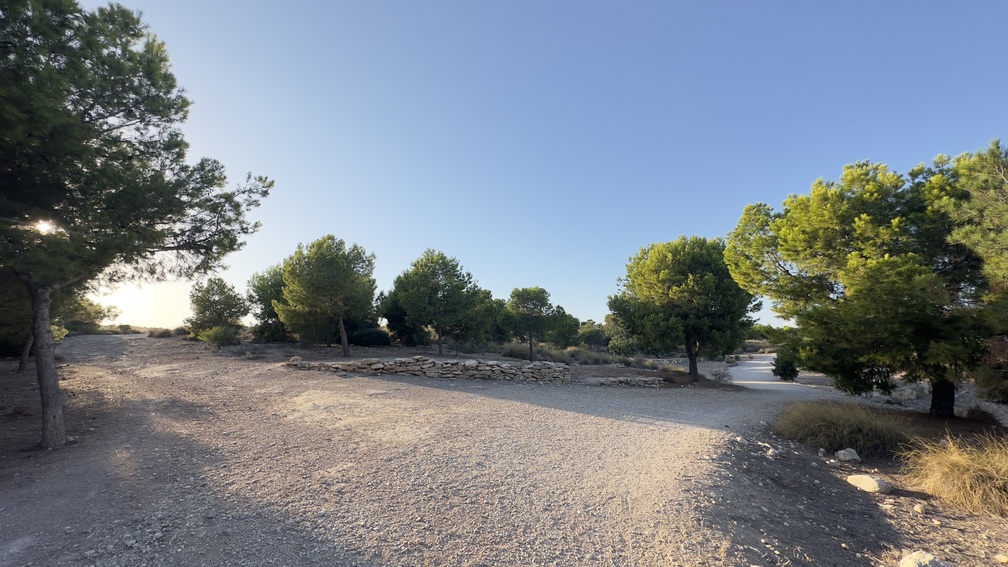
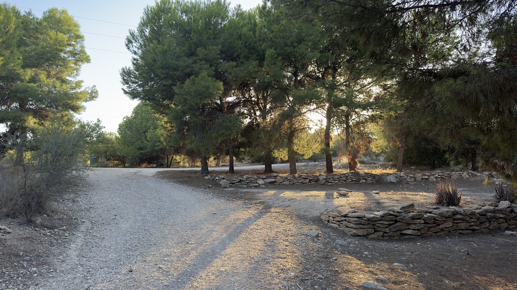
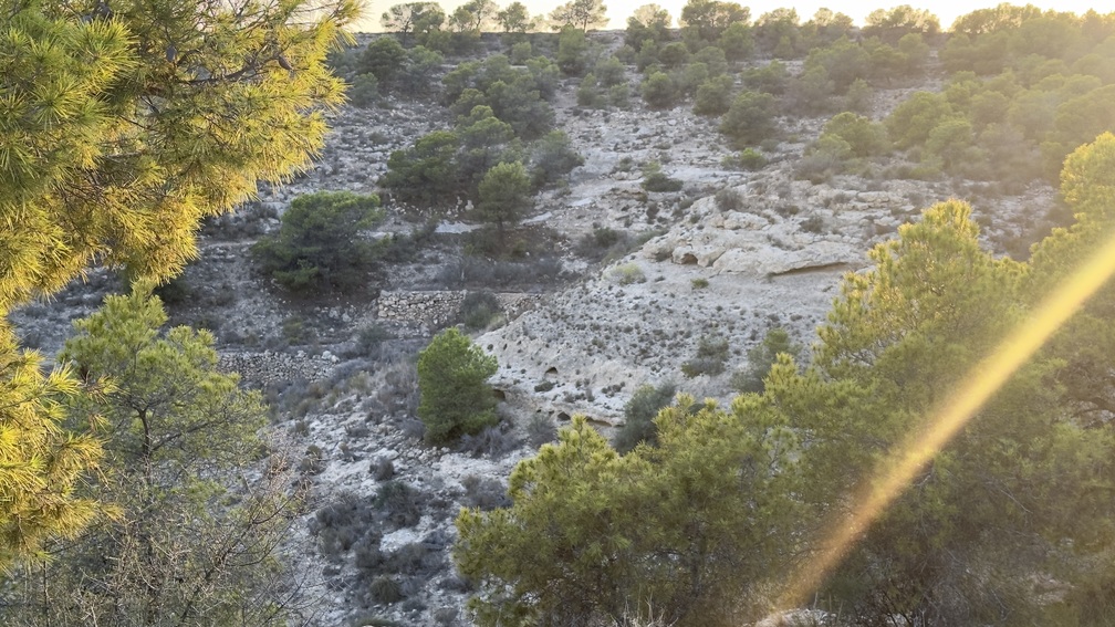
We reach a fork in the trail and take the path to the right, leaving the left path as an alternate route (2a). In the central section, you’ll notice terraced areas where old stone walls from former agricultural terraces have been restored. Restoring these abandoned terraces not only helps conserve the soil but also enhances the cultural and aesthetic value of the landscape. In these terraces, reforestation has focused on planting carob trees (Ceratonia siliqua), common in local farming, alongside other Mediterranean trees and shrubs like strawberry trees (Arbutus unedo) and wild pomegranate (Punica granatum). Curiously, aloe vera plants (Aloe vera) grow sporadically along the edges of the terraces. Although some aloe species have naturalized in mild climates, they are not considered invasive plants that pose a threat to our flora in the Iberian Peninsula.

3. Path convergence

440 meters

Confluence of paths. As we walk, we spot stones painted with green marks along the path. These marks indicate the presence of “cone traps” nearby, baited with pheromones to attract and control the red palm weevil (Rhynchophorus ferrugineus). These traps are placed here even though there are no palm trees in the area because Monte Orgegia serves as a strategic barrier to help protect Alicante’s palm groves from this pest. As we continue the ascent, we see Cabeço d’Or to the north. Although this mountain is located between Busot and Aigües, its peak belongs to Alicante’s municipality.

4. Landscape. Huerta of Alicante

200 meters

Near the top of the mountain, on our right, we catch glimpses of what was once Alicante’s farmland, irrigated by water from the Embalse de Tibi (built in the late 16th century). This reservoir collected water from the Monnegre river and channeled it into the main irrigation ditch, which then distributed it to various storage basins to address the river’s inconsistent flow. As we look out, our visual reference will be the Penya Migjorn, with a path through the plain that extends to the foot of Monte Orgegia, passing through old farms and remnants of the Huerta. The path becomes colorful again, with a blanket of mallows (Lavatera arborea) on one side and, on the other, the esparto grass dotted with launaea (Launaea fragilis), better known as “rabbit lettuce” for its edible leaves rich in vitamin A.

5. Animal shelter

270 meters

About 40 meters off the path to the left, we find small animal shelters made of stones, a ground-level artificial water trough, and one of the stone piles used as refuges for wild rabbits (Oryctolagus cuniculus). The construction of these shelters, in addition to controlling and breeding rabbits, represents a project that contributes to the goal of repopulating the mountain with this key species in the food chain of the Comarca, without being harmful to their population growth as there are no crops nearby.

6. Mountain Viewpoint

80 meters

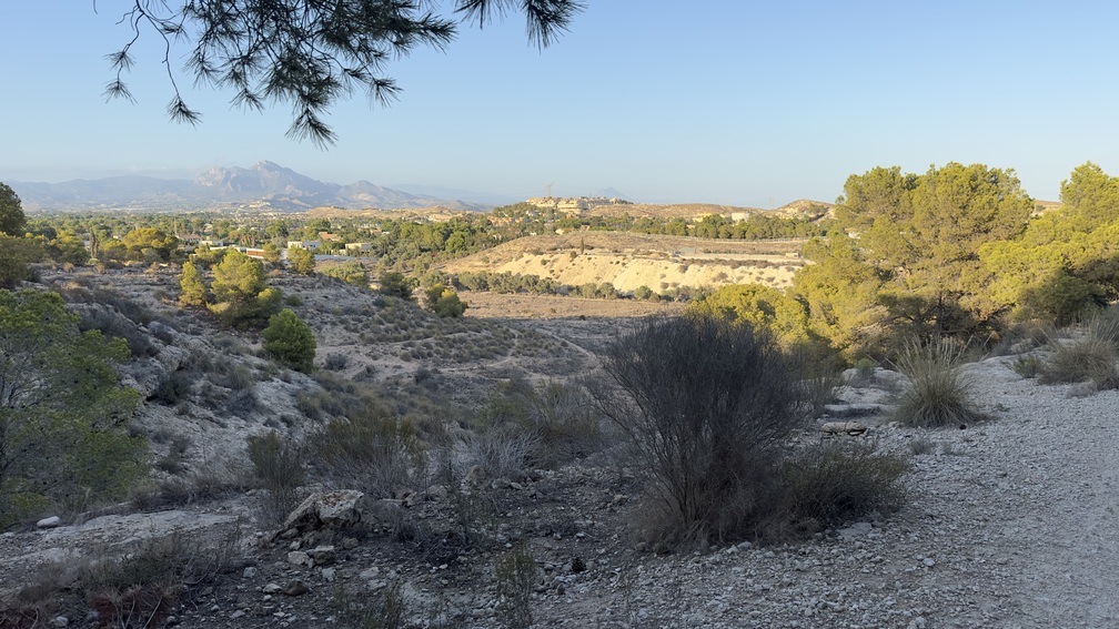
We arrive at a viewpoint with stunning views of the province’s mountainous landscape. From left to right, we can easily identify the peaks of Fontcalent, Sierra de las Aguilas, Sierra del Cid, Maigmo, Penya Migjorn, Carrasqueta, Cabeço d’Or, Aitana, and Puig Campana.

7. East Viewpoint

100 meters

East Viewpoint. We are at one of the highest points of this mountain, which barely reaches 100 meters above sea level. From here, we can see its interior landscape, the coastal strip, and the urban development stretching from Albufereta to San Juan-Muchavista beach, with views extending to Sierra Helada and Benidorm Island.

8. Fossil Zone

300 meters

Heading south, we passed an area where it is easier to find prehistoric marine remains; especially near the hills, you can appreciate the existence of fossils of sea urchins and bivalves, as well as nummulites, also called “small coins” due to their size and shape.

9. Mountain Irrigation Reservoir

270 meters

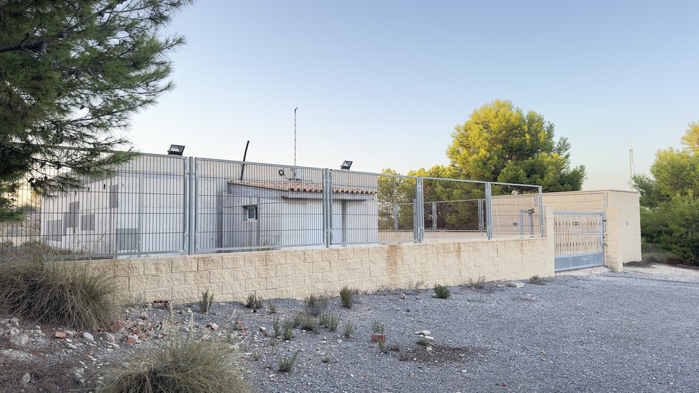
We come across a small building housing a water tank supplied by the water treatment plant. This water is used for irrigating the mountain through a drip system, ensuring its survival and serving as an important measure against wildfires.

10. Water Treatment Plant

330 meters

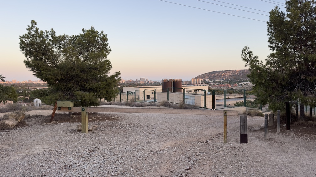
Turning right, we arrive at the Monte Orgegia Wastewater Treatment Plant (E.D.A.R). This facility collects and treats wastewater from the northern part of Alicante and parts of San Vicente, San Juan, and Muchamiel. Due to population growth, especially in summer, the plant was expanded to double its capacity and add a tertiary treatment process. This allows all treated water to be reused for agricultural irrigation, urban parks and gardens, private properties, and golf courses.
From here, we have 1,250 meters left to walk, skirting the treatment plant and reconnecting with the asphalt path leading back to our starting point.

Alternative route.

If we choose this route to connect with point 3 of our trail, the path will be shorter but rougher, narrowing as we go deeper into the mountain. On the other hand, we can walk alongside the gully and see the pine forest grow denser, making it easier to spot birds. You’ll notice their unique sounds and songs, including the cuckoo (Cuculus canorus).

The potential flora of Monte Orgegia, based on its climate and soil characteristics, belongs to the semi-arid thermomediterranean series typical of Alicante, with mastic shrubs and dwarf fan palms. However, due to urbanization and soil transformation from farming, the current vegetation is a degraded version of its potential. You’ll find Aleppo pines (Pinus halepensis), which are small due to shallow soil, along with aromatic plants like thyme (Thymus vulgaris) and rosemary (Rosmarinus officinalis). At the base of the mountain, carob trees (Ceratonia siliqua), olive trees (Olea europaea), and almond trees (Prunus dulcis) from abandoned crops. In the ramblas or valleys, the pine forest is denser with abundant shrubbery. As you walk through Monte Orgegia, you’ll also see examples of Alicante’s characteristic thorny vegetation.

Regarding the fauna, in the shrubs and abandoned crops, we find passerine birds (insectivores) such as the white wagtail (Motacilla alba), the great tit (Parus major), the robin (Erithacus rubecula), the serin (Serinus serinus), and the blackbird (Turdus merula). On the rocky areas, we can clearly distinguish the black wheatear (Oenanthe leucura) by its size and shiny black color. Among the raptors that fly over the mountain is the kestrel (Falco tinnunculus) and, already in it, the little owl (Athene noctua) with its undulating flight of rapid wing beats, making continuous descents and ascents.

Small mammals are also common, such as the wild rabbit (Oryctolagus cuniculus), Iberian hare (Lepus granatensis), house mouse (Mus musculus), and European hedgehog (Erinaceus europaeus). On the other hand, as for reptiles, the most representative species are the Iberian wall lizard (Podarcis hispanica), ocellated lizard (Lacerta lepida), Montpellier snake (Malpolon monspessulanus), and ladder snake (Rhinechis scalaris).

10. Water Treatment Plant

330 meters

Turning right, we arrive at the Monte Orgegia Wastewater Treatment Plant (E.D.A.R). This facility collects and treats wastewater from the northern part of Alicante and parts of San Vicente, San Juan, and Muchamiel. Due to population growth, especially in summer, the plant was expanded to double its capacity and add a tertiary treatment process. This allows all treated water to be reused for agricultural irrigation, urban parks and gardens, private properties, and golf courses.
From here, we have 1,250 meters left to walk, skirting the treatment plant and reconnecting with the asphalt path leading back to our starting point.

Alternative route.

If we choose this route to connect with point 3 of our trail, the path will be shorter but rougher, narrowing as we go deeper into the mountain. On the other hand, we can walk alongside the gully and see the pine forest grow denser, making it easier to spot birds. You’ll notice their unique sounds and songs, including the cuckoo (Cuculus canorus).

9. Mountain Irrigation Reservoir

270 meters

We come across a small building housing a water tank supplied by the water treatment plant. This water is used for irrigating the mountain through a drip system, ensuring its survival and serving as an important measure against wildfires.

8. Fossil Zone

300 meters

Heading south, we passed an area where it is easier to find prehistoric marine remains; especially near the hills, you can appreciate the existence of fossils of sea urchins and bivalves, as well as nummulites, also called “small coins” due to their size and shape.

7. East Viewpoint

100 meters

East Viewpoint. We are at one of the highest points of this mountain, which barely reaches 100 meters above sea level. From here, we can see its interior landscape, the coastal strip, and the urban development stretching from Albufereta to San Juan-Muchavista beach, with views extending to Sierra Helada and Benidorm Island.

6. Mountain Viewpoint

80 meters

We arrive at a viewpoint with stunning views of the province’s mountainous landscape. From left to right, we can easily identify the peaks of Fontcalent, Sierra de las Aguilas, Sierra del Cid, Maigmo, Penya Migjorn, Carrasqueta, Cabeço d’Or, Aitana, and Puig Campana.

5. Animal shelter

270 meters

About 40 meters off the path to the left, we find small animal shelters made of stones, a ground-level artificial water trough, and one of the stone piles used as refuges for wild rabbits (Oryctolagus cuniculus). The construction of these shelters, in addition to controlling and breeding rabbits, represents a project that contributes to the goal of repopulating the mountain with this key species in the food chain of the Comarca, without being harmful to their population growth as there are no crops nearby.

4. Landscape. Huerta of Alicante

200 meters

Near the top of the mountain, on our right, we catch glimpses of what was once Alicante’s farmland, irrigated by water from the Embalse de Tibi (built in the late 16th century). This reservoir collected water from the Monnegre river and channeled it into the main irrigation ditch, which then distributed it to various storage basins to address the river’s inconsistent flow. As we look out, our visual reference will be the Penya Migjorn, with a path through the plain that extends to the foot of Monte Orgegia, passing through old farms and remnants of the Huerta. The path becomes colorful again, with a blanket of mallows (Lavatera arborea) on one side and, on the other, the esparto grass dotted with launaea (Launaea fragilis), better known as “rabbit lettuce” for its edible leaves rich in vitamin A.

3. Path convergence

440 meters

Confluence of paths. As we walk, we spot stones painted with green marks along the path. These marks indicate the presence of “cone traps” nearby, baited with pheromones to attract and control the red palm weevil (Rhynchophorus ferrugineus). These traps are placed here even though there are no palm trees in the area because Monte Orgegia serves as a strategic barrier to help protect Alicante’s palm groves from this pest. As we continue the ascent, we see Cabeço d’Or to the north. Although this mountain is located between Busot and Aigües, its peak belongs to Alicante’s municipality.

2. Fork – Terraced area

260 meters

We reach a fork in the trail and take the path to the right, leaving the left path as an alternate route (2a). In the central section, you’ll notice terraced areas where old stone walls from former agricultural terraces have been restored. Restoring these abandoned terraces not only helps conserve the soil but also enhances the cultural and aesthetic value of the landscape. In these terraces, reforestation has focused on planting carob trees (Ceratonia siliqua), common in local farming, alongside other Mediterranean trees and shrubs like strawberry trees (Arbutus unedo) and wild pomegranate (Punica granatum). Curiously, aloe vera plants (Aloe vera) grow sporadically along the edges of the terraces. Although some aloe species have naturalized in mild climates, they are not considered invasive plants that pose a threat to our flora in the Iberian Peninsula.

1. Main access Forest Park

0 meters

We begin our journey at the entrance to the mountain, on Calle Azafran, behind the Provincial Home. As a starting reference, look for a semicircular stone bench with an ornamental fountain at its center. From here, we’ll ascend a gently sloping path (a 50-meter elevation gain over 1,250 meters to the viewpoint) along the main trail. This path is lined with Aleppo pines (Pinus halepensis), carob trees (Ceratonia siliqua), and a few hackberries (Celtis australis) at the start. The understory includes blackthorn (Rhamnus lycioides), esparto grass (Stipa tenacissima), and aromatic shrubs like rosemary (Rosmarinus officinalis), lavender (Lavandula officinalis), and field chamomile (Arthemis arvensis). The latter resembles chamomile (Matricaria chamomilla) but lacks its delicate fragrance and has a bitter taste.

This site is registered on wpml.org as a development site. Switch to a production site key to remove this banner.